ProjectGemini™

Overview
ProjectGemini™ is The Acceleration Agency's Active Digital Twin platform that can provide rapid integration of multiple data points into a single pane of glass that renders a realistic and intuitive command and control system. An Active Digital Twin intelligence infrastructure gains insights that drive better products, optimize operations and costs and create breakthrough orchestrated experiences. With partnerships such as Unity, Esri, and NVidia's Omniverse, TAA can build Active Digital Twin Platforms to any scale ranging from large cities, ports, highways, hospitals, and stadiums to construction job-site management to real-time warehouse management with hundreds of thousands of trackable objects.
Features
Multi-Scale
Vehicle Tracking
Vessel Tracking
Emergency Tracking
MARSEC
Location Services
Weather
Inventory Tools
ArcGIS 3D Building Layers
ArcGIS Base Map Layers
ArcGIS Data Layers
ArcGIS Custom Elevation Layers
Predictive Vessel Movement
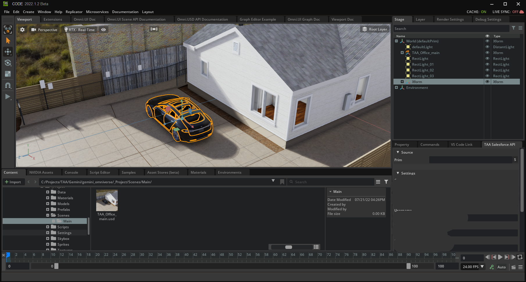
NVIDIA Omniverse Support
Unity WebGL Viewer
Mobile App
Desktop App
Admin Tools
Authoring Tools
Edge Agents
Data Abstraction Layers
Sensor Fabric
Multiple Viewers
Unity WebGL Viewer
Temperature
Audio
PROBLEM
Ever increasing amounts of data being collected through dozens of separate digital systems and data silos with no unified view. Operations for critical infrastructure, city operations, etc. are increasing in complexity but the amount of time to assess and monitor not able to keep pace. Integrating and displaying the multiple data feeds required for an Active Digital Twin can take a huge investment in time and money
SOLUTION
An Active digital twin provides a realistic, "single-pane of glass" perspective where every sensor, system, and event converges; accelerating operator understanding and powering real-time situational awareness.
Project Gemini's Edge Agent architecture abstracts the connection points and messaging layers thereby dramatically reducing the time needed to implement Active Digital Twins at any scale.
.png)
Abstraction & Integration Layers
Multiple abstraction layers allow clients to connect a variety of sensors, databases/CRMs, and Object Integration tools. Project Gemini includes integration examples of SalesForce and Silicon Labs sensor/tag network to show real time location, temperature, audio, and orientation.
01
Data Integration Layer
Clients can connect a range of data sources
including full function CRMs like Salesforce.
02
Sensor Fabric Layer
Real time sensor layer is abstracted
so that a range of sensors can be integrated
to transmit information.
Location, temperature,
audio, orientation, infrared, video,
humidity, airflow, etc.
03
Messaging Abstraction Layer
The Messaging abstraction layer (RabbitMQ)
provides a range of viewer(s) (Unity, Omniverse, etc.)
connection to backend systems and servers.
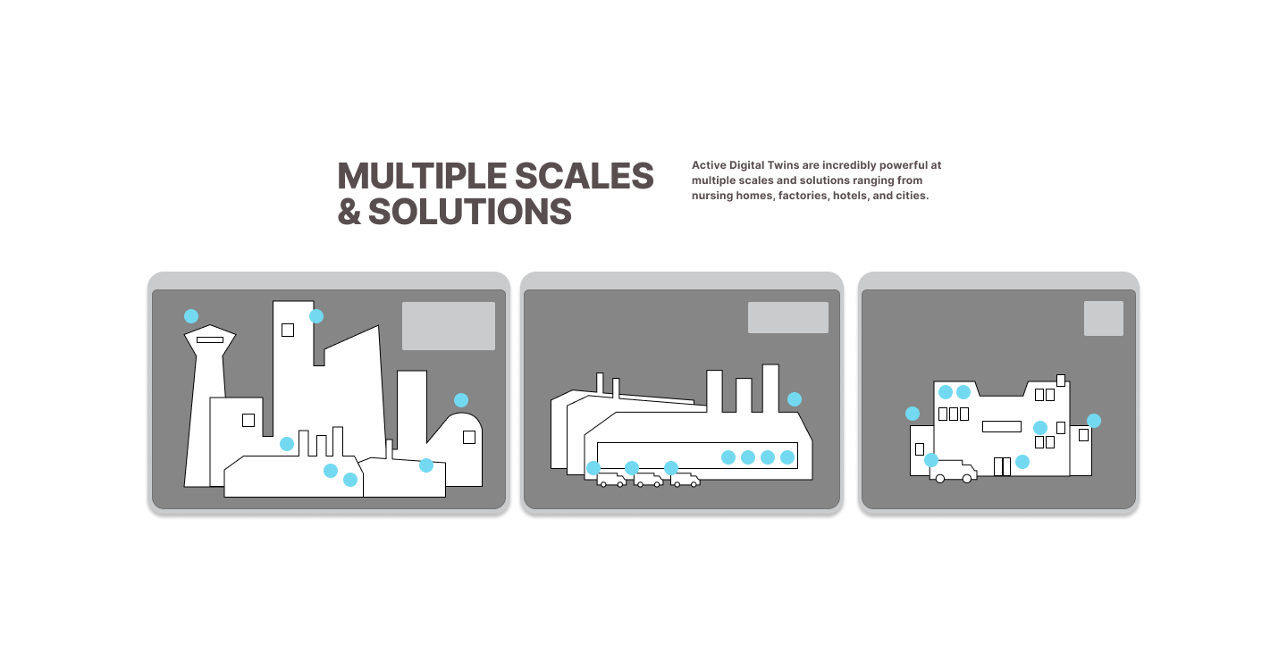
Multi Scale
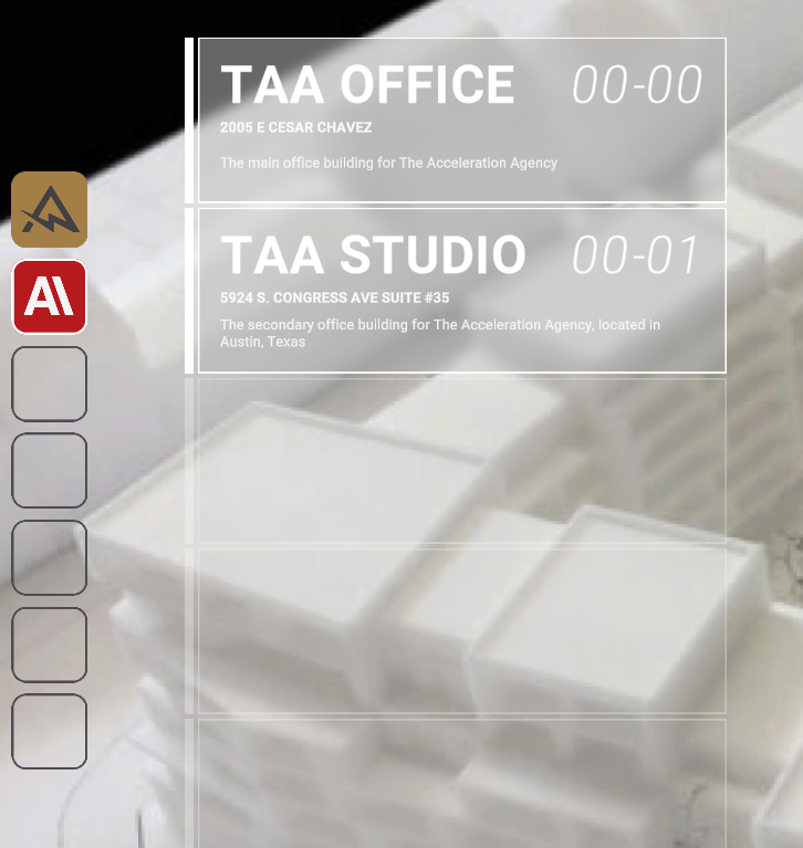
ProjectGemini can be deployed at any scale; from a single office up to a full city. It can even be made interoperable with operators able to move seamlessly inside, outside and between buildings/facilities across large geographical areas
optional description

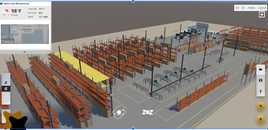
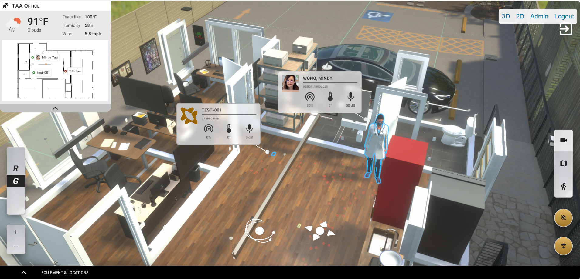

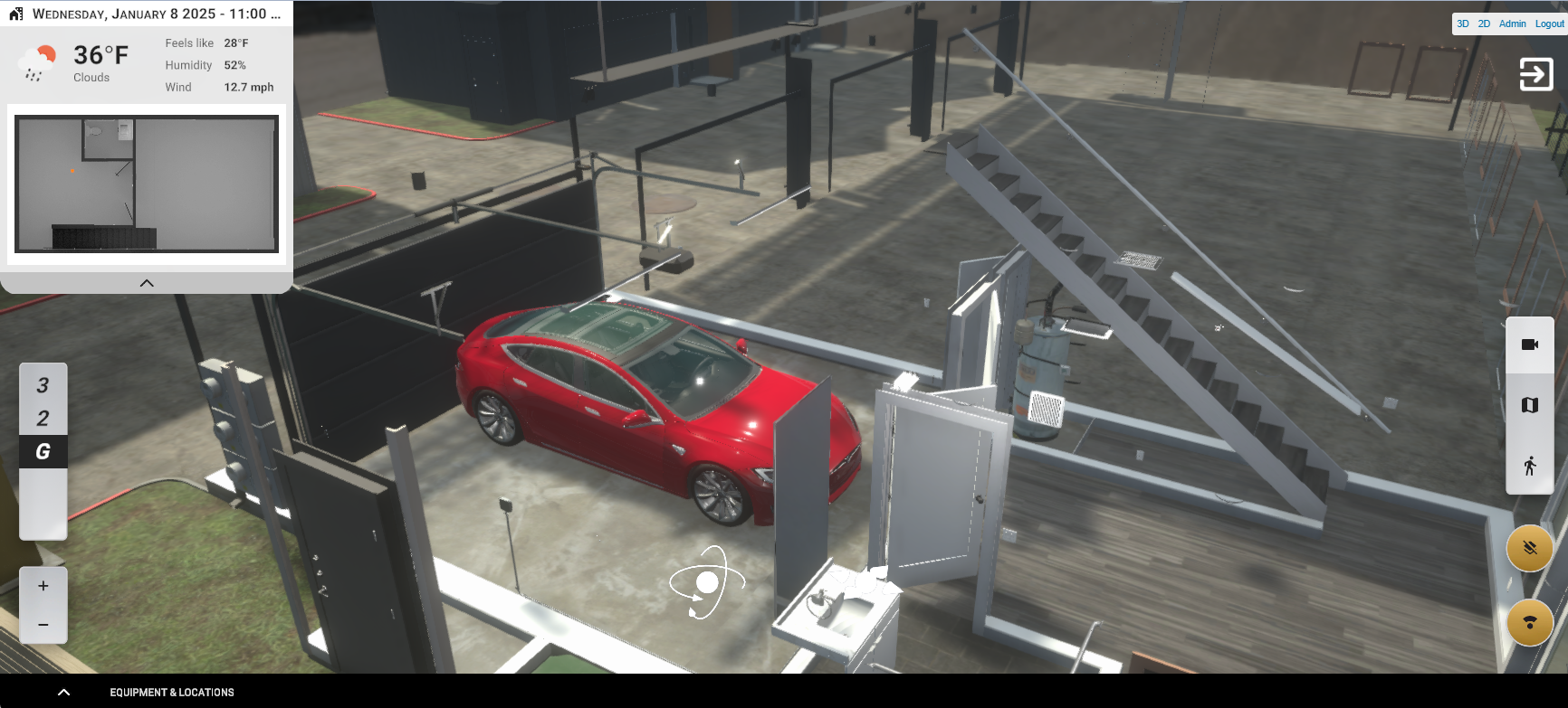
Real Time Information Display on Any Device
Access the ProjectGemini Active Digital Twin from any compatible connected device via the Unity WebGL viewer or installed Unity client. Additionally the Gemini Active Digital Twin can be rendered with an unprecedented level of visual fidelity, scale and simulation level via the NVIDIA Omniverse RTX Real Time Renderer.
01
View Manipulation
View the Active Digital Twin from directly overhead,
3rd Person Isometric or even 1st Person.
Various tools for manipulation of the view include
rotation, zoom, view presets, changing Location
(multiple campuses), and Floor Selection
(for multi-story locations).
02
Building & Location
Manage multiple locations in real time.
Each location can display Location Name,
Date, Time, Number of People onsite,
Weather, etc. in a summary interface element.
03
People & Inventory
Staff and Inventory can be tracked
via Location Services through the Data
Layer (ex. SalesForce) and Sensor Fabric.
Information displayed can include: Name,
Title, ID#, Gender, DOB, temperature,
audio, Quantity, Date of last interaction,
orientation, and signal strength
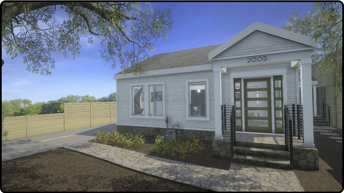
Built with ProjectGemini: OPTICS
Interactive 3D representation of the Port of Corpus Christi's facilities, vehicles, emergency services, security video, and vessels providing real-time comprehensive situational awareness.
Stats
20+
Systems Integrated so far
12 months (or less)
To Deploy a full scale Active Digital Twin
10,000+
Entities able to be tracked
6+
Viewers, platforms, and types supported (mobile, desktop, AR, VR, web, Unity, Omniverse, etc.)
5-10%
Faster Response Time and Lower Cognitive Load (versus traditional dashboards)
Services provided to ProjectGemini
System Integration Architecture
Technical Architecture
Mobile App Development (iOS/Android)
Backend Engineering
Frontend Engineering
UX|UI Design
API Development & Integration
Platform Engineering
Active Digital Twin Development
Maritime Port Intelligence Platform Development
Geospatial Systems (GIS) Development & Integrations
Spatial Computing
Real-Time Event & Alert Systems
Sensor & Device Data Fusion
xIoT Sensor Fabric Development
IoT Device Integration
UWB (Ultra Wideband) Development
NFC (Near Field Communication) Development
BLE (Bluetooth Low Energy) Development
Wearables (NFC/BLE/UWB)
Rapid Prototyping
RFID (Radio-Frequency IDentification) Development
Edge Compute Applications
Cloud Architecture (AWS/GCP/Azure)
Real-Time Streaming Data
Salesforce Integration
CI/CD Pipelines
Forecasting & Predictive Modeling
Observability, Logging & Monitoring
CJIS (Criminal Justice Information Services) Certification
On Premise / Cloud Hybrid Deployment
ESRI ArcGIS Unity Plugin Development
Multi-Scale Support (Building, Campus, City)
NVIDIA Omniverse Integration
Inventory Tools Integrations (CRMs)
Weather.gov Integration
Location Services Integration & Display
MARSEC (Coast Guard Security Level) Integration
Emergency API Integration (Computer Aided Dispatch)
Vessel Information (AIS) API Integration
ESRI ArcGIS 3D Building Layer Creation
ESRI ArcGIS Base Map Layer Integrations
ESRI ArcGIS Data Layer Integrations
ESRI ArcGIS Custom Elevation Layer Creation
Desktop App Development (Win, Mac)
3D Asset Creation: Vehicles
3D Asset Creation: Avatars
3D Asset Creation: Vessels
3D Asset Creation: Buildings
3D Asset Creation: Equipment
Site Scan Data Conversion & Integration
Vehicle Telemetry API Integration