OPTICS: Active Digital Twin
Overview
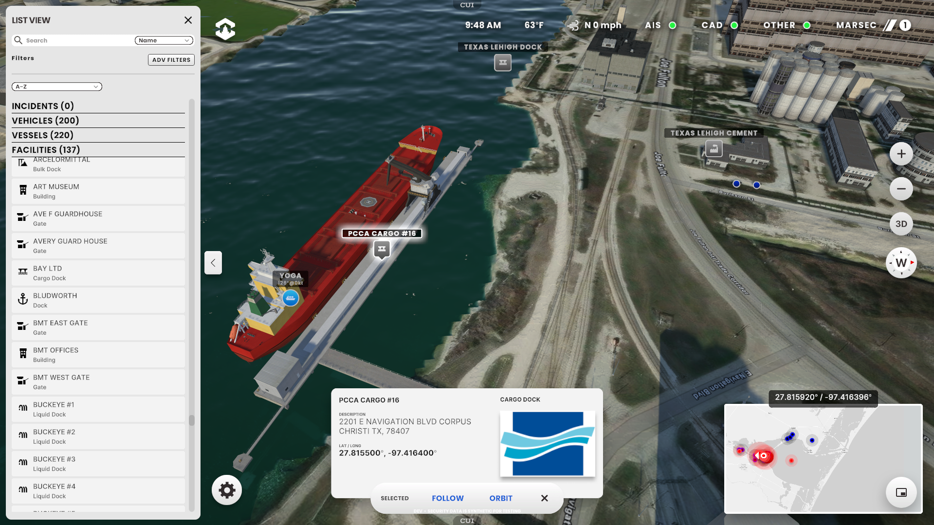
OPTICS (Overall Port Tactical Information Computer System) delivers an interactive 3D command layer of the Port of Corpus Christi: fusing facilities, vehicles, emergency teams, security video, and vessel traffic into highly secure real-time situational awareness. The system ranks among the largest and most data-dense digital twins ever created, earning multiple awards and coverage across major industry press. The Acceleration Agency built OPTICS using its ProjectGemini™ Active Digital Twin platform. The project was funded by a FEMA-administered Port Security Grant from The Department of Homeland Security.
Features
Vehicle Tracking
Emergency Tracking
Vessel Tracking
MARSEC
Weather
ArcGIS 3D Building Layers
ArcGIS Base Map Layers
ArcGIS Data Layers
ArcGIS Custom Elevation Layers
Predictive Vessel Movement
Mobile App
Desktop App
Admin Tools
Monitoring Tools
On Premise / Cloud Hybrid
CJIS Security Level
Authoring Tools
Security Camera Video
PROBLEM
An ever-growing volume of data flows through dozens of disconnected digital systems and silos, leaving Port operations without a single, comprehensive operating picture. Meanwhile, as operational complexity increases, the ability to quickly assess conditions and respond is lagging behind the real-time speed required for critical, time-sensitive situations.
SOLUTION
ProjectGemini™ powers the OPTICS active digital twin, delivering a realistic, single-pane-of-glass perspective that unifies every sensor, system, and event; accelerating operator understanding and driving real-time situational awareness.
.png)
Port of Corpus Christi

Energy Port of the Americas
Since 1926, the Port of Corpus Christi has grown into the nation’s largest energy export gateway and the world’s third-largest crude oil export port. Direct dock, refinery, rail, and highway access drive billions of dollars in throughput each year.
Port Stats
#1 U.S. Oil Port
#2 U.S. LNG Port
#3 Crude in World
7000+ Vessels per Year
30K Acres Managed
54' Deep Channel
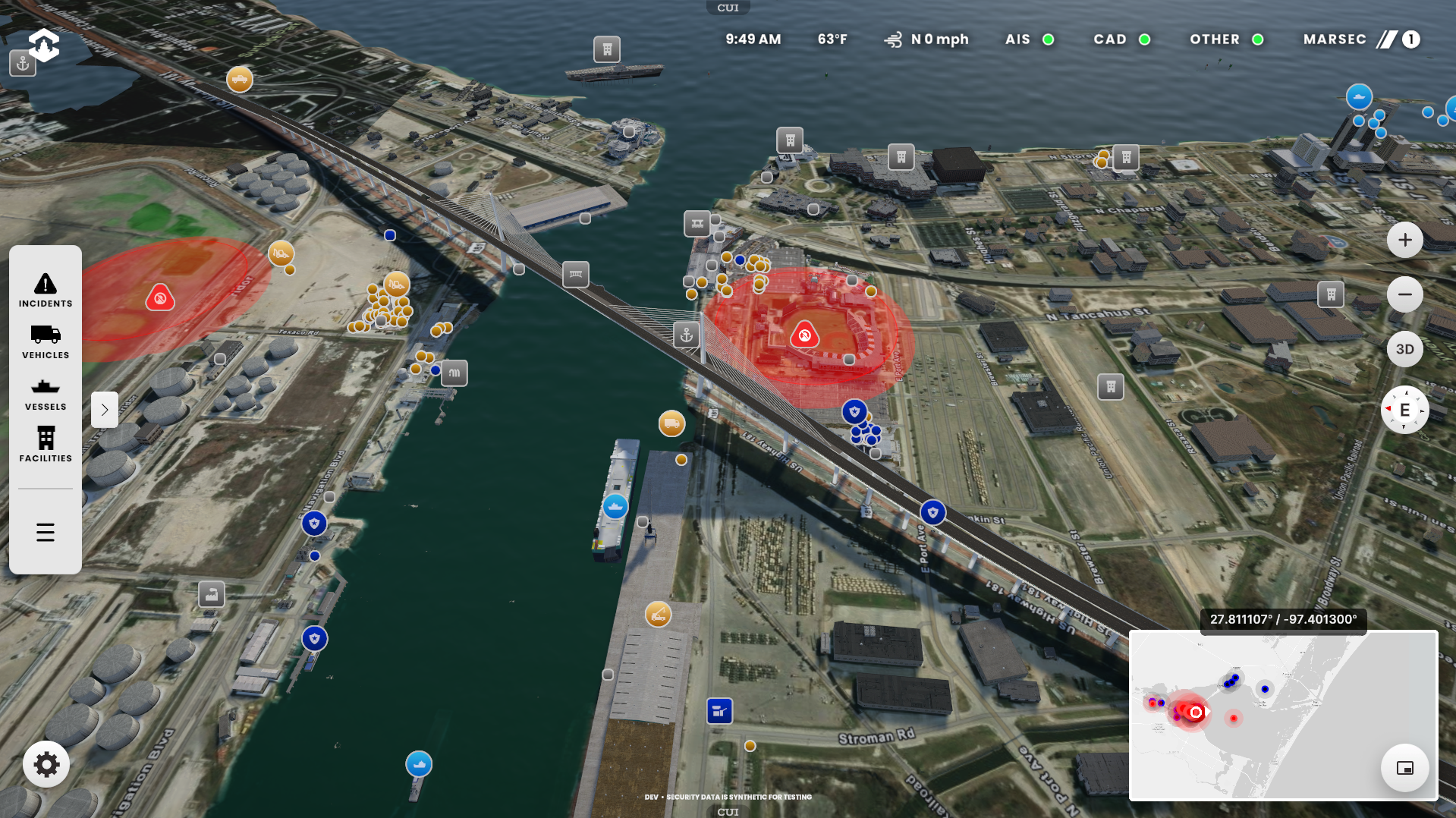
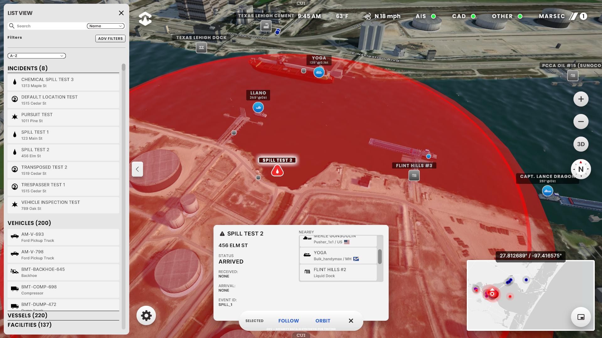
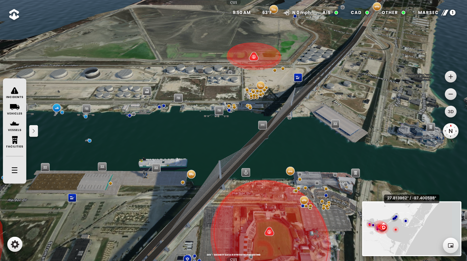
Emergency Incidents
Information, Location, and Nearby Data
OPTICS displays CJIS (Criminal Justice Information Services) Security Compliant Computer Aided Dispatch data entered by Port Police into their Dispatch Tool including locations and status of active security incidents (Spills, Collisions, Trespassers, Fires, etc) and security units (vehicles and vessels).
OPTICS adds additional data by providing a radius around the incident and providing all nearby vessels, facilities and units within that perimeter to aid in security assessment. The details for the incidents can be displayed in a list view that can be sorted and filtered and/or by selecting an individual incident. NOTE: Displayed Computer Aided Dispatch data and security locations (gates and cameras) is synthetic to comply with CJIS requirements.
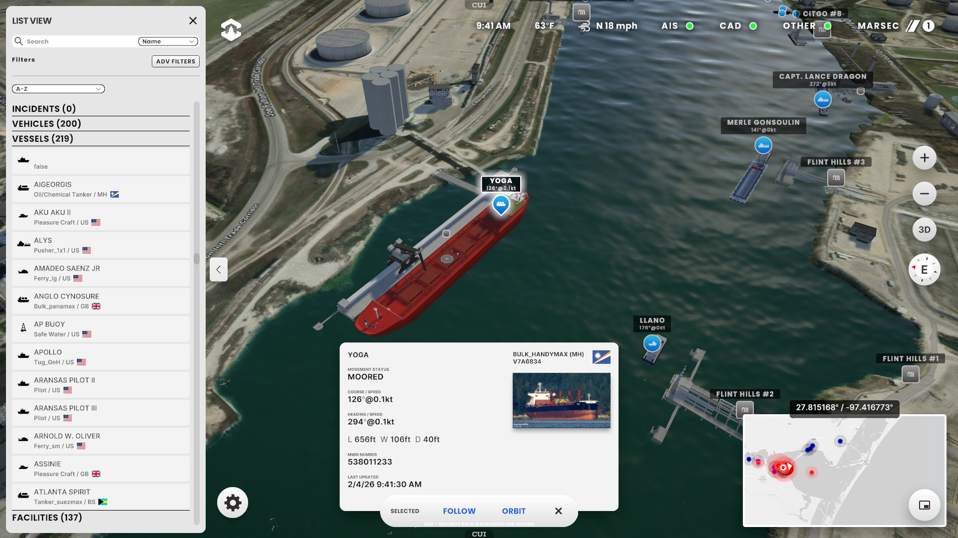
Vessels
Information, Location, and Movement
OPTICS consumes AIS (automatic information system) radio transponder data from the hundreds of vessels in the Port area to display 3D models and information. Tankers, Tractor Tugs, Push Tugs, Bulk Cargo, Vehicle Carriers, Dredgers, Pleasure, Sailing Vessels, Fishing, Coast Guard, Police, and Fire vessel details can be displayed in a list view that can be sorted and filtered and/or by selecting an individual vessel.
Using machine learning OPTICS provides predicted location information for all vessels. Over time this information will be used to optimize vessel traffic flow to increase cargo throughput and annual revenue while maintaining safety.


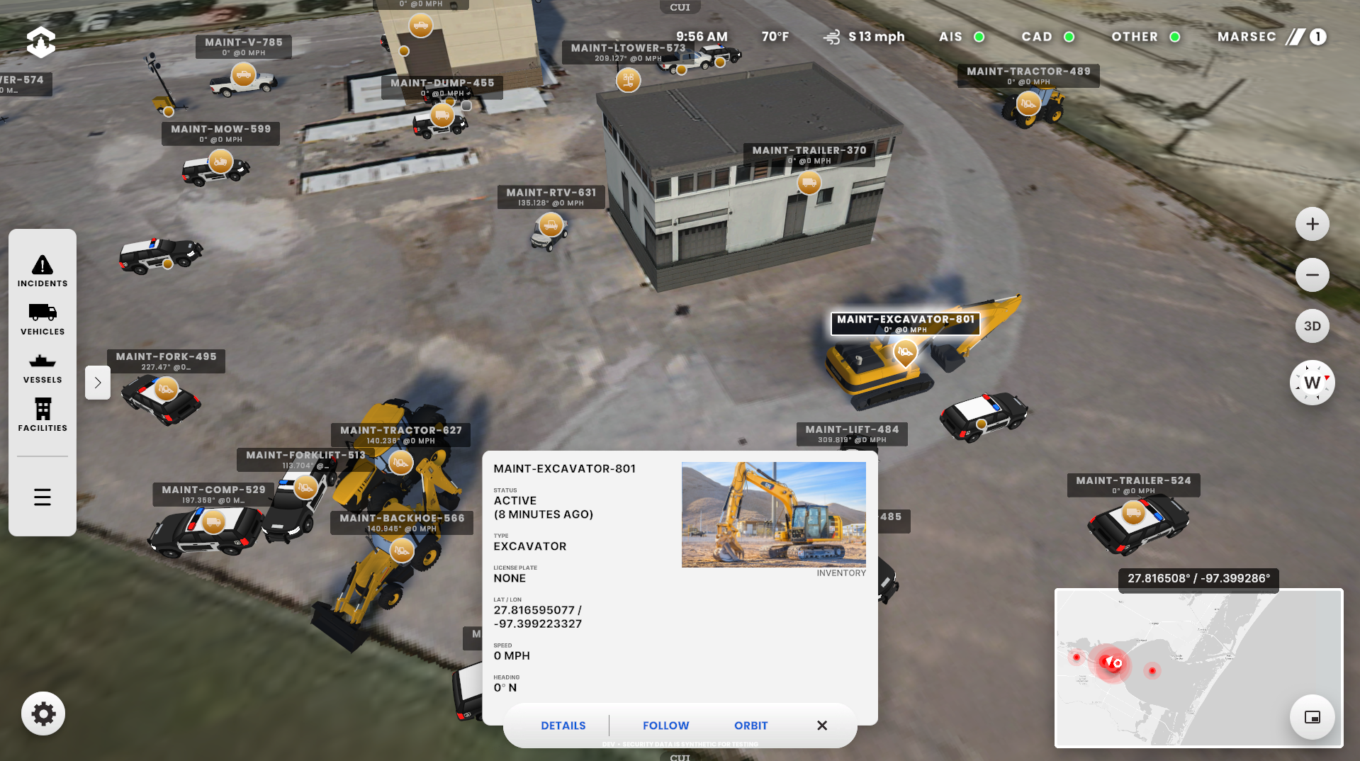
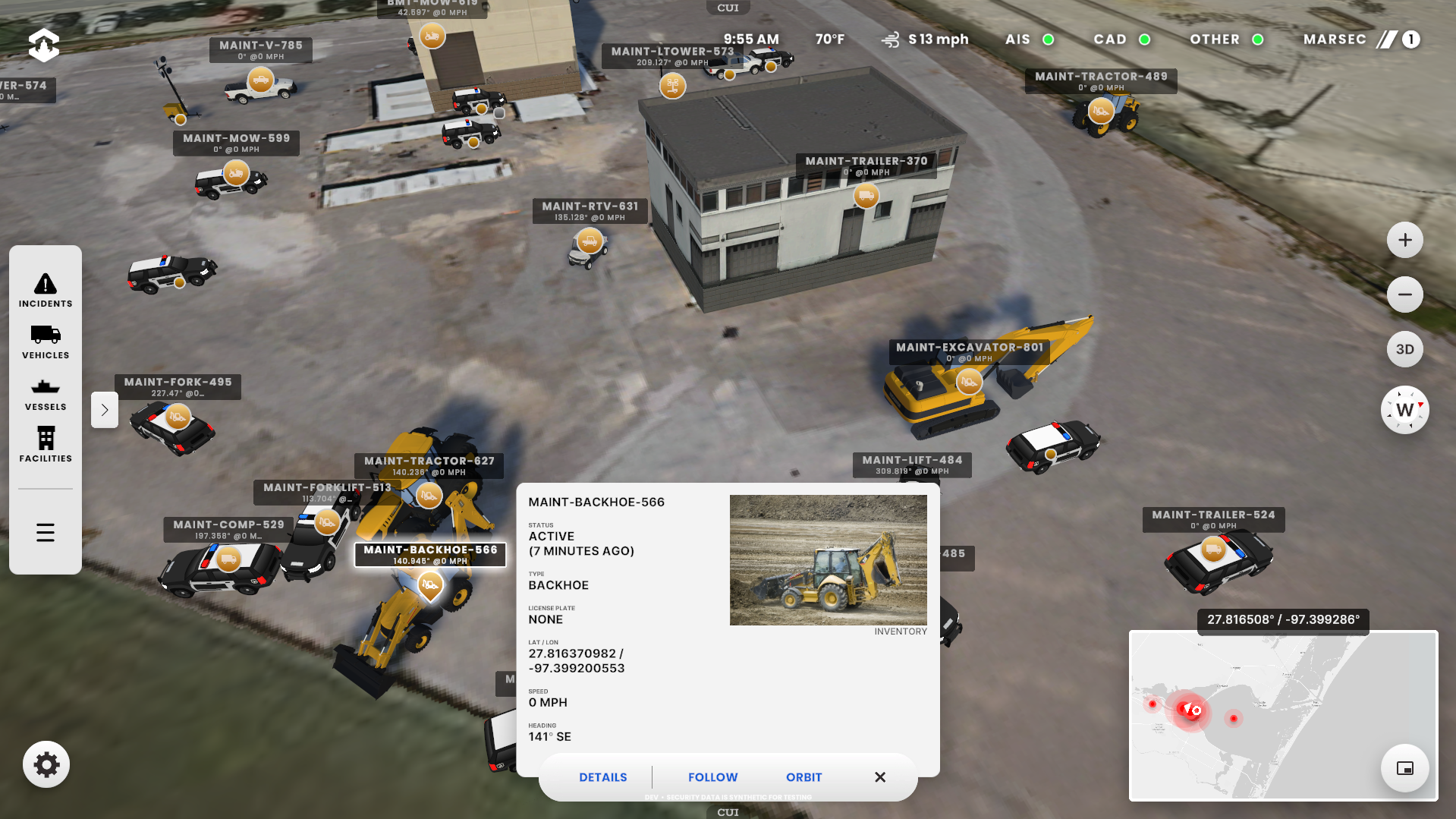
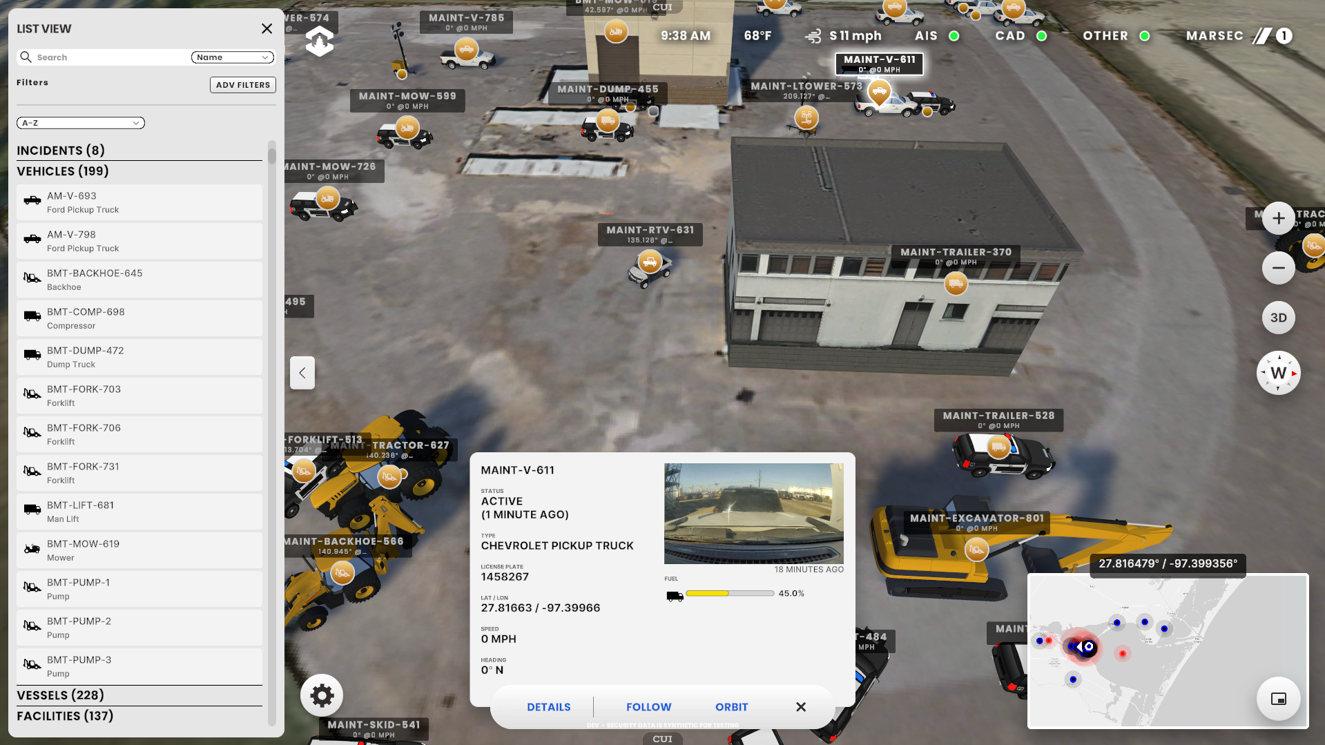
Vehicles and Equipment
Information, Location, and Movement
Samsara sensor data (names, types, fuel, location, speed, dash cam photos, etc.) is used to display 3D models, movement (ML predicted) & information for all Port owned vehicles & equipment. This includes Police Vehicles, Excavators, Trucks, RTVs, Cranes, Light Towers, Backhoes, Forklifts, and more.
Facilities
Information and Location
Hundreds of Key Port Facility Locations are displayed in OPTICS including Oil Docks, Cargo Docks, Administration Buildings, Security Cameras, Bridges and Security Gates are displayed including Private and Port maintained facilities. The details for the facilities can be displayed in a list view that can be sorted and filtered and/or by selecting an individual facility. NOTE: Displayed security locations (gates & cameras) is synthetic data to comply with CJIS requirements
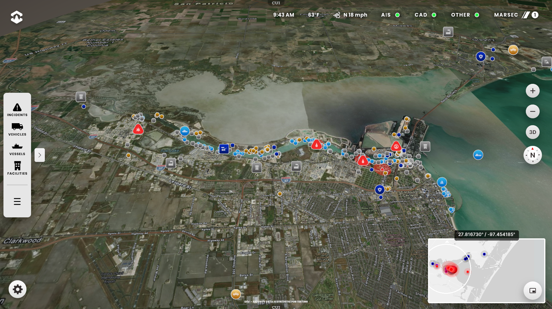
Other Data: Weather / Ocean Data, MARSEC
Current weather conditions, weather forecasts, weather radar in the mini map and sensor data from area Aids to Navigation (water temperature, salinity, windspeed, water level, barometer, etc) is viewable in the application. MARSEC, the Coast Guard’s three-tiered system of Maritime Security is also displayed.


Long Term Planning
Port operators can use OPTICS for long term planning by changing the visibility of certain elements. For example the New Harbor Bridge was under construction during the first phase of the project so the bridge could be made visible as if it was complete to simulate changes in traffic and navigation.


Result
9 Months
Phase 1 Built & Deployed
10+
Systems integrated into a single pane of glass
2000+
Entities (Vessels, Vehicles, Cameras, Facilities, Equipment) tracked in real-time
50+
Square miles covered
5-10%
Faster Response Time and Lower Cognitive Load (versus traditional dashboards)
Recognition
OPTICS has earned multiple awards, coverage across major industry press and TAA has given keynotes at many industry events.
- Two 2025 Lighthouse awards from the American Association of Port Authorities two categories: Security Practices and Technology.
- 2025 Esri innovation award for the use of ArcGIS technology
- Keynotes: Unity Industry Conference, Esri Developer Conference, Port of the Future Conference, Smart Digital Ports of the Future

Services provided to OPTICS
UX|UI Design
Backend Engineering
Frontend Engineering
Active Digital Twin Development
Maritime Port Intelligence Platform Development
ESRI ArcGIS Unity Plugin Development
Unity3D App Development
Geospatial Systems (GIS) Development & Integrations
CJIS (Criminal Justice Information Services) Certification
System Integration Architecture
Technical Architecture
Rapid Prototyping
Mobile App Development (iOS/Android)
Containerization (Docker/ECS/K8s)
On Premise / Cloud Hybrid Deployment
Access Control & Credentialing
API Development & Integration
Real-Time Event & Alert Systems
Edge Compute Applications
CI/CD Pipelines
Security Engineering
Real-Time Streaming Data
Staff Tools & Back-of-House Applications
Forecasting & Predictive Modeling
Project Management
Product Documentation
Technical Documentation
Observability, Logging & Monitoring
On Premise Infrastructure Deployment
ESRI ArcGIS 3D Building Layer Creation
Weather.gov Integration
MARSEC (Coast Guard Security Level) Integration
Location Services Integration & Display
Emergency API Integration (Computer Aided Dispatch)
Vessel Information (AIS) API Integration
ESRI ArcGIS Base Map Layer Integrations
ESRI ArcGIS Data Layer Integrations
ESRI ArcGIS Custom Elevation Layer Creation
3D Asset Creation: Vehicles
3D Asset Creation: Vessels
3D Asset Creation: Buildings
3D Asset Creation: Equipment
Machine Learning Algorithms
Site Scan Data Conversion & Integration